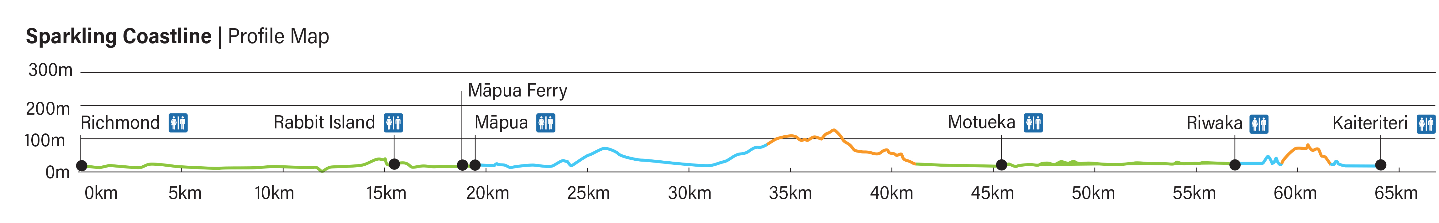
- Ride Length
- 64 km
- Riding Time
- 4-6 hours
- Grade
- 1-3
- Status
- Complete
If you are already on the cycle trail from Nelson, simply follow the trail signs. If you are joining in Richmond, access the trail from Beach Road/Fittal Street, or the west end of Champion Road near the ASB Aquatic Centre car park.
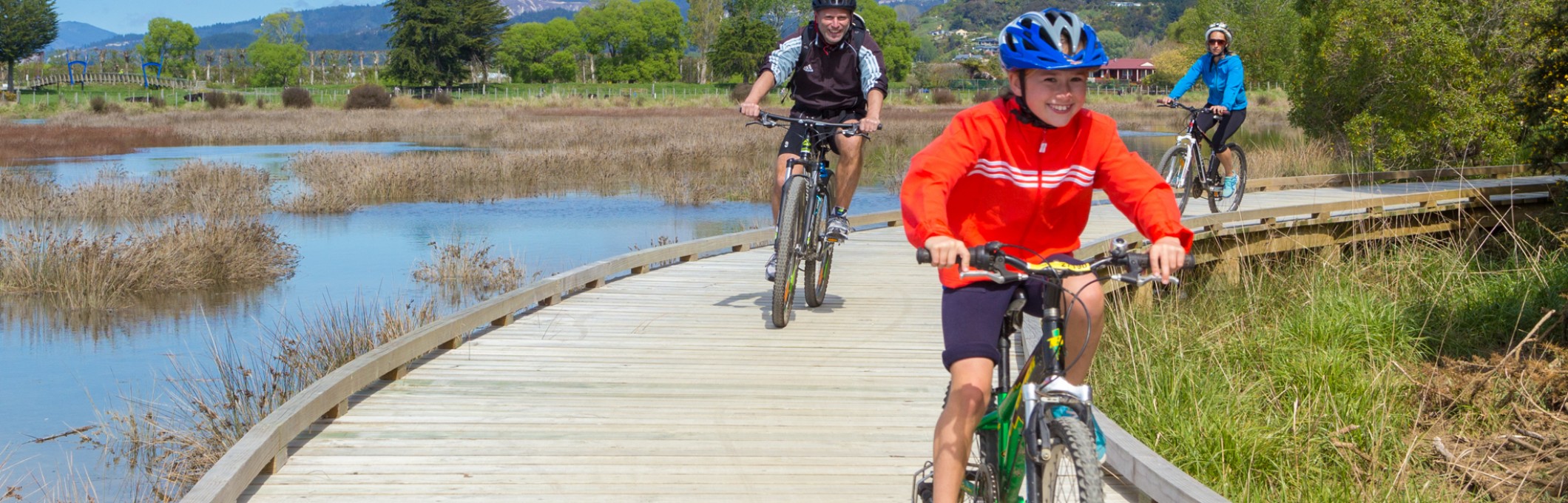
Coastal pathways and board walks take you around the beautiful, ecologically significant Waimea Inlet. It is ideally done a few hours either side of high tide for the best scenery, although bird spotting is best when the tide is out.
The Waimea Inlet is the largest enclosed estuary in the South Island and home to wading and sea birds including the bar-tailed godwit, white heron, royal spoonbill, little egret, Australasian bittern, and banded rail.
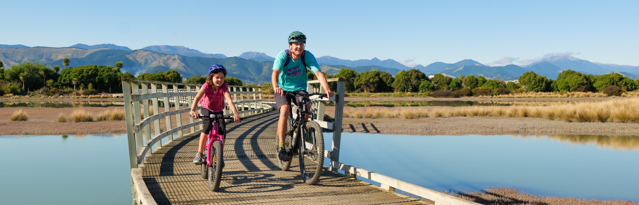
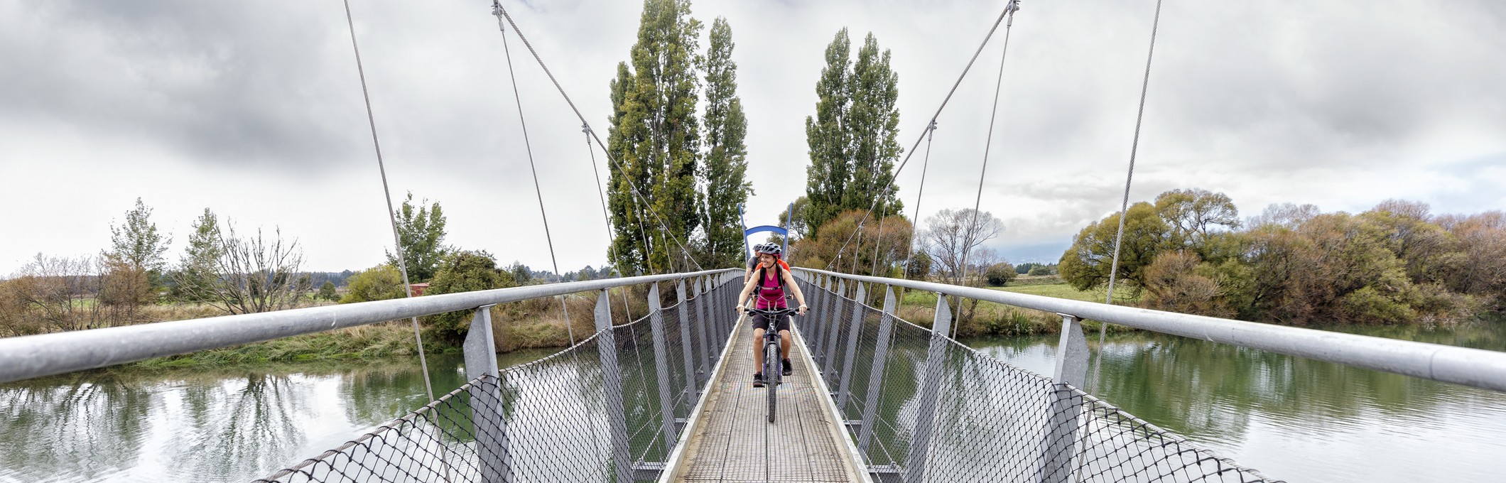
Next, head across the Waimea river suspension bridge. Then it’s to Rabbit Island, through pine forest, out to the expansive beach front, and to the Māpua Ferry. Rabbit Island is a popular recreation area for swimming and picnics. Please note that dogs are not allowed on Rabbit Island.
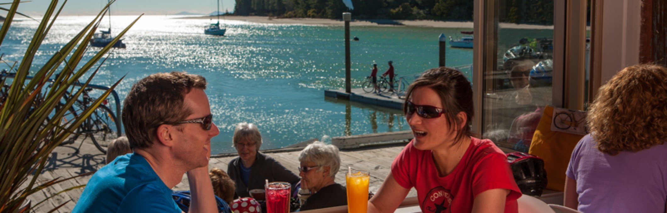
The Māpua ferry transfers cyclists to the seaside village of Māpua, where you can indulge in lunch, a relaxing drink and interesting gift shopping. Māpua also has accommodation, bike hire, and guided tours of the surrounding countryside and wineries.
Visit the Mapua Ferry website for information on operating hours, which change with the seasons. Purpose built to accommodate cyclists and foot passengers the ferry takes approximately seven minutes to make its crossing. Bike racks take care of your bike whilst you sit back and enjoy the only ferry crossing on any cycle trail in New Zealand. It is not possible to travel between Rabbit Island and Māpua if you do not use the ferry.
The ferry is affected by adverse weather conditions (wind and rough sea) and if it isn't running for any reason a notice will be posted on our website and Facebook page
After Māpua, there are a few short climbs as the trail winds along apple orchards, vineyards, working artist studios and galleries to Tasman village. With luck you should have a sea-breeze helping push you before taking on the final climb up Tasman View Road. At the top, your effort is rewarded with amazing 360° views taking in Tasman Bay and the Arthur Range.
A picnic table, shade sail and information boards plus a toilet make this a perfect rest spot before heading down the other side. The decent is a little steep and a bit rough in places.
Please note the trail does not go through the centre of Motueka township. To head into town, continue down the main road. Motueka is the best place to stock up if you need food supplies and there are several bike shops too. You can then follow the main road out, until it joins up with the trail again. Or reverse your steps and re-join the trail
This section of the cycle trail starts on Old Wharf Road and goes past the shipwrecked Janie Seddon. Ride at a casual pace, and take in the spectacular coastal scenery. Raumanuka Reserve is a historical site for local iwi and an amazing spot to see local bird life including the majestic Kotuku.
Next is the small settlement of Riwaka and here the trail splits. Heading inland takes you towards the Motueka Valley. Or, you could choose to do a spectacular there-and-back ride into the gorgeous Kaiteriteri beach, the gateway to the Abel Tasman National Park.
Follow the signs as the trail follows the coastline next to the road into Kaiteriteri. Shortly after an underpass you will enter the Kaiteriteri Mountain Bike Park and the ‘Easy Rider’ trail. The trail steps up a grade with steep pinches, tight corners and narrow trail in places. While easy mountain biking, some people may choose to get off and push the more challenging stretches. The 'Easy Rider' is definitely preferable to riding along the road which is narrow in places with high summer traffic flows.
Exit ‘Easy Rider’ at the mountain bike skills park and then it’s just a short ride down the road to the glorious golden sands of Kaiteriteri beach. Here you will find food, drink, and accommodation. The Kaiteriteri Mountain Bike Hub by the bus park has an air supply and bike tools, should your bike need a quick fix.
Get a Taste of …
Waimea Inlet and its birdlife, Waimea River, Rabbit Island, Māpua, the Māpua Wharf precinct, local food, orchards, vineyards, working artist studios and galleries, panoramic views of Tasman Bay and Arthur Range, Motueka township, Sandspit and Raumanuka Reserve, Riwaka village, Kaiteriteri Mountain Bike Park, and Kaiteriteri beach.